 |
 |
 |
|
GPSMAP® 9213 is the integrated touchscreen chartplotter designed for captains
who demand the best. Enjoy edge-to-edge clarity with 4K resolution on a glass
helm with premium design and materials. Plot your paradise faster than ever with
processing power that’s up to 7 times faster than previous generations, and get
5GHz Wi-Fi® connectivity for ActiveCaptain® app updates.
Get a connected boating experience by linking your compatible MFDs, cameras,
sonars and more on the gigabit-speed Garmin BlueNet™ network. The full suite of
Garmin SailAssist™ features allows you to see wind speed, direction and other
critical data at a glance. When your hands are full, use spoken commands to
operate the chartplotter (compatible headset or smartwatch required; not
included).
Navigate on the water with preloaded Garmin Navionics+™ charts, or upgrade to
premium Garmin Navionics Vision+™ charts. Garmin Navionics+ comes with Auto
Guidance+™ technology, which helps you navigate and avoid land- and water-based
obstacles based on chart data (for planning purposes only and does not replace
safe navigation operations).
Model: 010-03176-01
-
Premium 4K IPS sunlight-readable touchscreen display
-
Glass helm with edge-to-edge design for seamless and modern
look
-
Processing power is up to 7 times faster than previous
generations for superior performance, plus get faster wireless ActiveCaptain®
app transfer speeds with 5GHz Wi-Fi® connectivity
-
Enjoy premium sailing features, such as sailing polars, plus
see laylines, race start line guidance and more with Garmin SailAssist™
features
-
Build extensive networks with reliable connectivity and
gigabit speeds on the Garmin BlueNet™ network
-
Enjoy high-quality entertainment with video integration
capabilities with HDCP distribution
-
Uses the NMEA?2000® and NMEA?0183® networks to connect to your
compatible autopilots, sensors and more; compatible with existing marine
ecosystems
-
Take command of monitoring, control and automation systems
with support for the EmpirBus™ system and other third-party solutions via
OneHelm™ integrated digital switching
-
Keep tabs on engine performance with extensive engine
integration, including SAE J1939 connectivity and a wide range of support for
outboard engine manufacturers
-
Navigate with preloaded Garmin Navionics+™ charts with Auto
Guidance+™ technology (for planning purposes only and does not replace safe
navigation operations); get support for Garmin Navionics Vision+™ charts with
premium features such as high-resolution relief shading
-
Connect your compatible Garmin devices and more with
integrated BLUETOOTH® and ANT® technologies; use spoken commands to control
the chartplotter with your compatible headset or Garmin smartwatch
-
Built for harsh marine conditions with an IPX7
water-resistance rating
PARADISE STARTS HERE
It’s the integrated 4K
touchscreen chartplotter for captains and anglers who demand the best. Enjoy
edge-to-edge clarity and luxury on a glass helm with premium design and
materials.

PREMIUM IPS SUNLIGHT-READABLE TOUCHSCREEN DISPLAY

UP TO 7 TIMES FASTER PROCESSING POWER THAN PREVIOUS GENERATIONS

GET CLARITY LIKE NEVER BEFORE ON A 4K DISPLAY

PRELOADED GARMIN NAVIONICS+ CHARTS WITH AUTO GUIDANCE+™ TECHNOLOGY1

GIGABIT SPEEDS ON THE GARMIN BLUENET™ NETWORK

NETWORK WITH MULTIPLE CHARTPLOTTERS, CAMERAS AND MORE
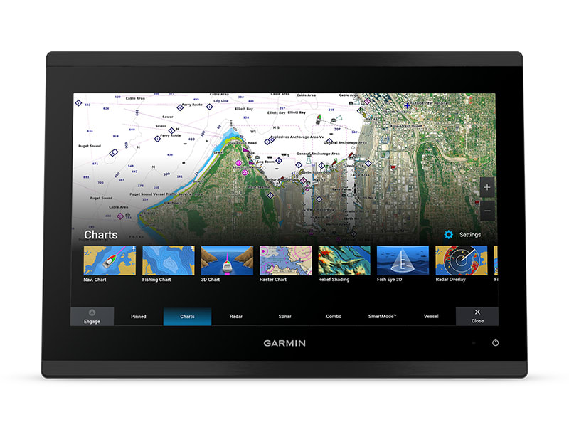
PREMIUM CHARTPLOTTER
The 4K IPS sunlight-readable touchscreen display and edge-to-edge design
provide a seamless and luxurious modern look.
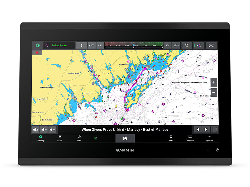
FASTER. MUCH FASTER.
Processing power is 7 times faster than previous generations for superior
performance; draw charts quickly, and calculate Auto Guidance+ routes1 with
lightning speed with a Garmin Navionics+ subscription.
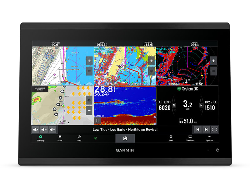
GARMIN BLUENET NETWORK
Build extensive networks with multiple chartplotters, cameras, radars and
sonars — and enjoy gigabit-speed networking.
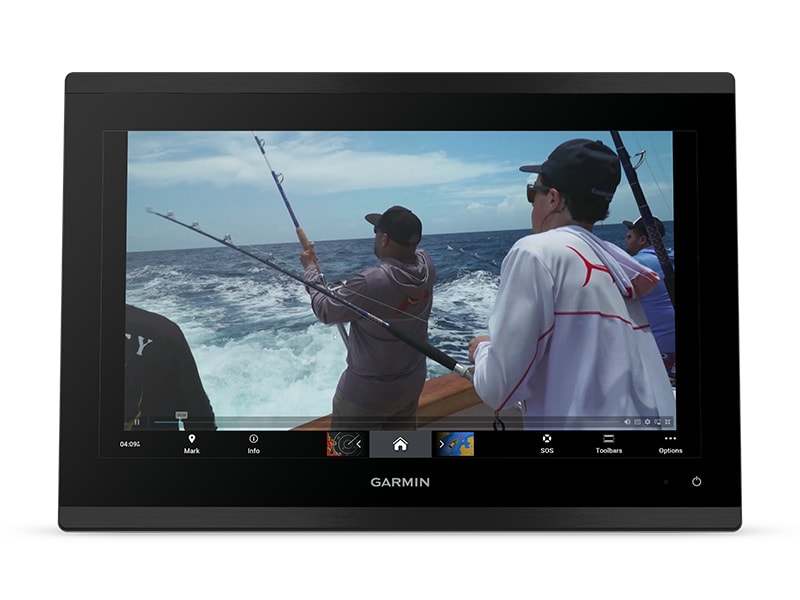
ENTERTAINMENT OPTIONS
Enjoy audio and video integrations that allow you to show and hear the same
video throughout the screens and speakers on your network.
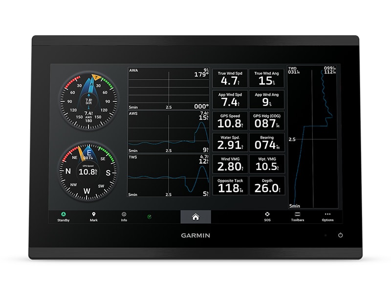
GARMIN SAILASSIST™ SAILING FEATURES AND SAILING POLARS
View laylines, race start line guidance, enhanced wind rose, heading and
course-over-ground lines, true wind data fields and tide/current/time
slider, and more. Plus the polar
table shows key data, so you know whether you need to adjust sail trim.
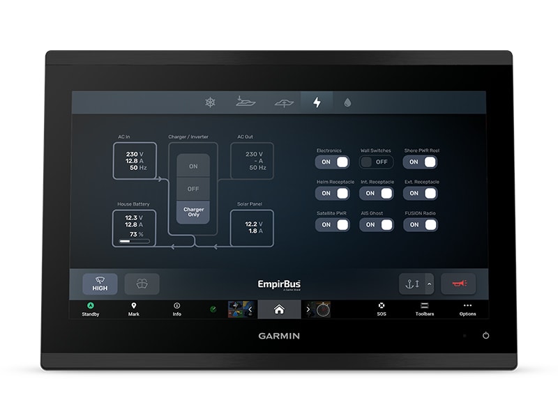
CONNECT YOUR ECOSYSTEM
Take command through digital system integrations to monitor, automate and
control your vessel. The chartplotter uses the NMEA 2000® network
to connect to your compatible accessories.
CONNECT

SOFTWARE UPDATES
Get wireless software updates via the ActiveCaptain® app with
your compatible smartphone or tablet.

ENGINE MONITORING
Keep tabs on engine performance with extensive engine integration.

CUSTOM LOOK
Manufacturers can customize the homepage layout and splash screen for a
brand tailored experience.
NAVIGATE

MAPPING
Navigate with optional Garmin
Navionics+ charts that include Auto Guidance+ technology, daily
updates and more1 (subscription
required).

KNOW WHERE YOU ARE
Get your precise location with the built-in dual-frequency 10 Hz GPS.

AUTOPILOT
Control the autopilot with any compatible chartplotter on the network with
autopilot integration.
INTEGRATE

CONNECT CAMERAS
Get extensive camera support and control to see footage directly on the
chartplotter.

CONTROL WITH YOUR WATCH
Connect to your chartplotter with your compatible Garmin smartwatch.

WIRELESS CONNECTIVITY
Connect compatible devices with integrated Bluetooth® and
ANT® technologies.
FISH MAPPING
Get comprehensive fishing data with the Fish Mapping™ feature
from SiriusXM® Radio
(accessory purchase and subscription required).

VERBAL COMMANDS
Use spoken commands to control the chartplotter through your compatible
headset or quatix® smartwatch.
General
|
|
DIMENSION |
13.2" x 9.19" x 3.56" (33.5 cm x 23.4 cm x 9.1 cm) |
|
WEIGHT |
9.1 lbs (4.13 kg) |
|
WATER RATING |
IPX7 |
|
TOUCHSCREEN |
x |
|
DISPLAY TYPE |
4K, IPS; Mini LED (Local Dimming) backlight |
|
DISPLAY SIZE |
11.57" x 6.50" x 13.27" diagonal (29.4 cm x 16.5 cm x 33.7 cm diagonal) |
|
DISPLAY RESOLUTION |
3840 x 2160 pixels |
|
MOUNTING OPTIONS |
Bail, flat or flush |
|
INPUT |
Touchscreen |
|
POLARIZED LENS VIEWABILITY |
|
Maps & Memory
|
|
ACCEPTS DATA CARDS |
2 microSD™ cards
(on rear of product) |
|
SUPPORTS USB CARD READER |
x |
|
WAYPOINTS |
5,000 |
|
TRACK POINTS |
50,000 |
|
TRACKS |
50 saved tracks |
|
NAVIGATION ROUTES |
100 |
Sensors
|
|
GPS |
x |
|
GLONASS |
x |
|
GALILEO |
x |
|
BEIDOU |
x |
|
HAS BUILT-IN RECEIVER |
x |
|
RECEIVER |
10 Hz |
|
NMEA 2000 COMPATIBLE |
x |
|
NMEA 0183 COMPATIBLE |
x |
|
SUPPORTS WAAS |
x |
|
SUPPORTS MULTI-BAND, MULTI-CONSTELLATION GPS |
|
Built-in Maps
|
|
BUILT-IN AUTO GUIDANCE+ |
x |
|
GARMIN NAVIONICS+ INLAND & COASTAL |
x |
|
GARMIN NAVIONICS+ (COASTAL) |
x |
|
GARMIN NAVIONICS+ (INLAND) |
x |
|
TIDE TABLES |
|
Optional Map Support
|
|
BLUECHART G3 |
x |
|
BLUECHART G3 VISION |
x |
|
LAKEVÜ G3 |
x |
|
LAKEVÜ G3 ULTRA |
x |
|
GARMIN NAVIONICS+™ |
x |
|
GARMIN NAVIONICS VISION+™ |
x |
|
TOPO 100K |
x |
|
STANDARD MAPPING |
x |
|
GARMIN QUICKDRAW CONTOURS |
x |
|
RASTER CHART SUPPORT |
|
Chartplotter Features
|
|
SMART MODE COMPATIBLE |
x |
|
AIS |
x |
|
DSC |
x |
|
SUPPORTS FUSION-LINK™ COMPATIBLE RADIOS |
x |
|
GCV BLACK BOX SONAR SUPPORT |
x |
|
ACTIVECAPTAIN® COMPATIBLE |
x |
|
SUPPORTS VOICE COMMANDS |
x |
|
GRID (GARMIN REMOTE INPUT DEVICE) COMPATIBLE |
x |
|
GRID 20 COMPATIBLE |
x |
|
WIRELESS REMOTE COMPATIBLE |
x |
|
SAILING FEATURES |
x |
|
SPOKEN AUDIO ALERTS |
x |
|
ONEHELM SUPPORT |
|
Electrical Features
|
|
POWER INPUT |
10 to 32 Vdc |
|
TYPICAL CURRENT DRAW AT 12 VDC |
3.6 A |
|
MAXIMUM CURRENT DRAW AT 12 VDC |
4.14 A |
|
MAXIMUM POWER USAGE AT 10 VDC |
44 W |
Sonar Features
|
|
DISPLAYS SONAR |
x |
|
TRADITIONAL SONAR (DUAL FREQUENCY/BEAM) |
yes (with GCV™ black box, sold separately) |
|
SUPPORTS BUILT-IN XCHIRP |
yes (with compatible black box sonar) |
|
SUPPORTS BUILT-IN RAPIDRETURN |
yes (with compatible black box sonar) |
|
CLEARVÜ |
yes (with compatible black box sonar) |
|
SIDEVÜ |
yes (with compatible black box sonar) |
|
PANOPTIX™ SONAR |
x |
|
LIVESCOPE |
|
Connections
|
|
NMEA 2000® PORTS |
1 |
|
NMEA 0183 INPUT (RX) PORTS |
1 |
|
NMEA 0183 OUTPUT (TX) PORTS |
1 |
|
VIDEO INPUT PORTS |
1 (BNC composite); 1 HDMI (HDCP compliant) |
|
VIDEO OUTPUT PORTS |
1 HDMI |
|
J1939 PORTS |
1 |
|
GARMIN BLUENET NETWORK PORTS |
2 |
|
USB PORTS |
yes (1x USB-C) |
|
BLUETOOTH® PAIRING |
x |
|
ANT® (CONNECTIVITY) |
x |
|
GARMIN WI-FI NETWORK (LOCAL CONNECTION) |
x |
|
WI-FI FREQUENCY BANDS |
2.4 GHz & 5 GHz |
|
AUDIO OUTPUT
yes |
In the box
- GPSMAP 9213 premium
chartplotter
- Power cable
- Backbone/drop cable (2
meters) and T-connector for the NMEA 2000® Network
- Bail mount with knobs
- Flush mount kit
- Protective cover
- Trim piece snap covers
- Documentation
Manuals
|
|
|
 |
|
 |
|
|
|
 |
|
 |
|
Note: The price is subject to change at any time without any notice. Not responsible for any typographical errors. Any products can be cancelled from sale at any time.
- All products sold here come with Full Manufacturer's Warranty
- Email us at
- [email protected] for any quesitons
 WARNING: This product can expose you to chemicals including Di-n-hexyl Phthalate, DnHP, which is known to the State of California to cause reproductive harm, and Vinyl Chloride which is known to the State of California to cause cancer. For more information go to P65Warnings.ca.gov. WARNING: This product can expose you to chemicals including Di-n-hexyl Phthalate, DnHP, which is known to the State of California to cause reproductive harm, and Vinyl Chloride which is known to the State of California to cause cancer. For more information go to P65Warnings.ca.gov.
|
|
|
|
|
|
| Compatible Accessories for this product... |
|
|
|
|

 GPSMAP9213
